Map Software
Advertisement
Engauge Digitizer v.4 1
This open source, digitizing software converts an image file showing a graph or map, into numbers. The image file can come from a scanner, digital camera or screenshot. The numbers can be read on the screen, and written or copied to a spreadsheet.
Advertisement
MB Feng Shui Bagua
MB Free Bagua Software is a remarkable and accurate Feng Shui program that helps one understand how the surrounding environment relates to the various aspects of human life. This interactive program has a simple to user interface and also a basic idea as
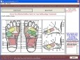
MB Reflexology
MB Free Reflexology is a combination software which teaches you the basics of the two types of touch therapy healing reflexology and shiatsu self massage. The program is extremely simple and very useful for people of all ages who would like to practice
Live DXF2BMP v.1.0
Live DXF2BMP is free software that converts CAD generated drawing to raster image; drawings can be generated by any CAD program that support DXF format such as AutoCAD.
Xtreeme SiteXpert v.9 5
quicWith Xtreeme SiteXpert you can create and keep up-to-date a cross-browser site map quickly and easily. It is highly optimized code compatible with every major browser. It has lots of different navigation styles.
PersonalBrain v.6.0.7.9
PersonalBrain helps you organize all your Web pages, contacts, documents, emails and files in one place so that you can always find them - just like you think of them. This saves you time and makes your life easier!
ORIMA v.10.0
ORIMA is an LPS add-on providing advanced aerial triangulation and visual analysis tools.
StatPlanet v.2 3
StatPlanet is a browser-based interactive data visualization and mapping application. Use it to easily and rapidly create visualizations from simple Flash maps to advanced infographics. StatPlanet can be freely and easily hosted on your own website.
ERDAS Desktop 2011 v.11.0.3
ERDAS creates geospatial business systems that transform our earth's data into business information, enabling individuals, businesses and public agencies to quickly access, manage, process, and share that information from anywhere.
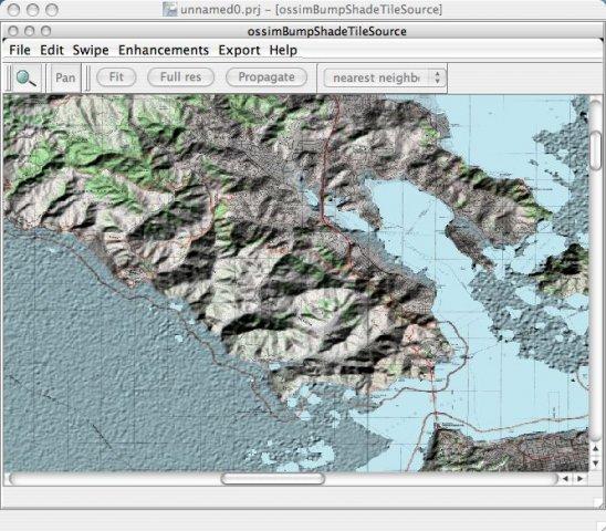
OSSIM - Open Source Software Image Map v.99
Open Source Remote Sensing OSSIM project, pronounced "awesome", will leverage existing algorithms/tools/packages from the open source community in construction of the ultimate Remote Sensing/Image Processing/GIS package.
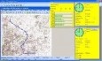
Map Monkey v.1.1.344
Map Monkey is an attempt to turn the very limited Destinator SDK (Software Development Kit) by Powerloc/HSTC into a user friendly, yet advanced GPS application for the PC.